With 6,000 kilometers of Pacific Ocean coastline on one side and the mighty Andes on the other, Chile is one long sliver of a country that encompasses a host of different climates. From Patagonia’s wild and rugged southern reaches – complete with fjords and craggy mountains – to the deserts of the northern portion of the country, Chile is also home to the mysteries of Easter Island.
It’s also got steamy hot springs, snow-capped volcanoes, primeval woodlands, rainforests, and many miles of beaches and far-flung coastlines to explore. Chile is an adventure-inducing country where modern cities sit on mountain backdrops; it is ripe for exploration.
In this post, we'll cover:
Norte Grande
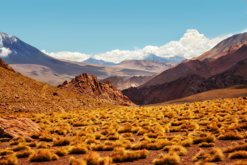
Set in the far north of Chile – and literally meaning “Great North” – the Norte Grande region features Pacific coastline and borders with Peru, Bolivia, and Argentina. This area of the country also contains the arid Atacama Desert, one of the driest places in the entire world.
Situated near the Atacama Desert itself are the sprawling Salar de Atacama, enclosed on all sides by the Andes themselves. From the area’s main town, crumbling San Pedro de Atacama, you can reach amazing sights like Valle de la Luna – named for its lunar landscape and eerie rock formations.
Heading to higher altitude are the highlands of Lauca National Park, where sights of grazing llama are commonplace, and volcanoes like the striking snow-peaked Parinacota (6,380m) jut out from the landscape. El Tatio, also situated in the Andes, is a field of active geysers that is constantly steaming.
Norte Chico
Comprising parts of Atacama and Coquimbo, Norte Chico is Chile’s “Little North” and is characterized by mountainous terrain, with the Andes on its west. Here, there are plenty of valleys and lots of fertile land, with cattle and fruit farms throughout the region.
This is where you’ll find the wine region of the Elqui Valley – a green oasis in an otherwise sunny, desert-like environment. Further from this inland area is part of the fascinating coastline that makes up Pan de Azucar National Park. This is a rugged area where the desert meets the coast for an intriguing place where you can see both cacti and penguins!
You can also see these aquatic birds at the Reserva Nacional Pinguino de Humboldt – a large area comprising several islands where you can not only spot the Humboldt penguin, but also catch sight of bottlenose dolphins and even humpback and sperm whales.
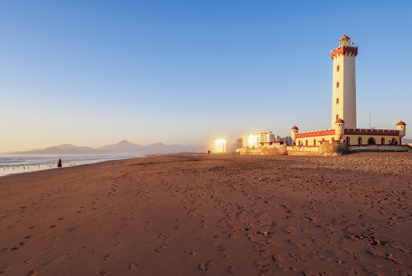
Elsewhere in Norte Chico are beaches where you can lounge around, such as the almost untouched Playa La Virgen. Head to the coastal city of La Serena for even more beaches backed by a famous lighthouse: El Faro.
Central Chile
With an essentially Mediterranean climate, Central Chile encompasses the middle of this unimaginably long country – complete with its capital, Santiago. Also the country’s largest city, it comes complete with a colonial core as well as skyscrapers wedged between a mountain backdrop and the Pacific Ocean.
The Parque Nacional Radal Siete Tazas encompasses a big chunk of mountainous Andes landscape, with forests and waterfalls to explore. In the O’Higgins Region of Central Chile, there is evidence of the country’s multicultural history, including livestock herding from Yugoslavia and Britain, breweries from Germany and Switzerland, and wineries from France and Italy.
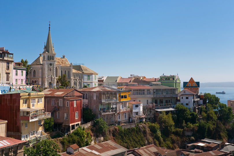
The area around major city Valparaiso – complete with steep roads, colourful houses and notable European influences – is known for its coastline. Neighbouring Vina del Mar includes a selection of top-rated sandy beaches – some of which are great surf spots. Meanwhile, plenty of hiking opportunities abound among the hills and streams of places like Rio Clarillo National Reserve and the Reserva Nacional Robleria Cobre de Loncha.
Southern Chile
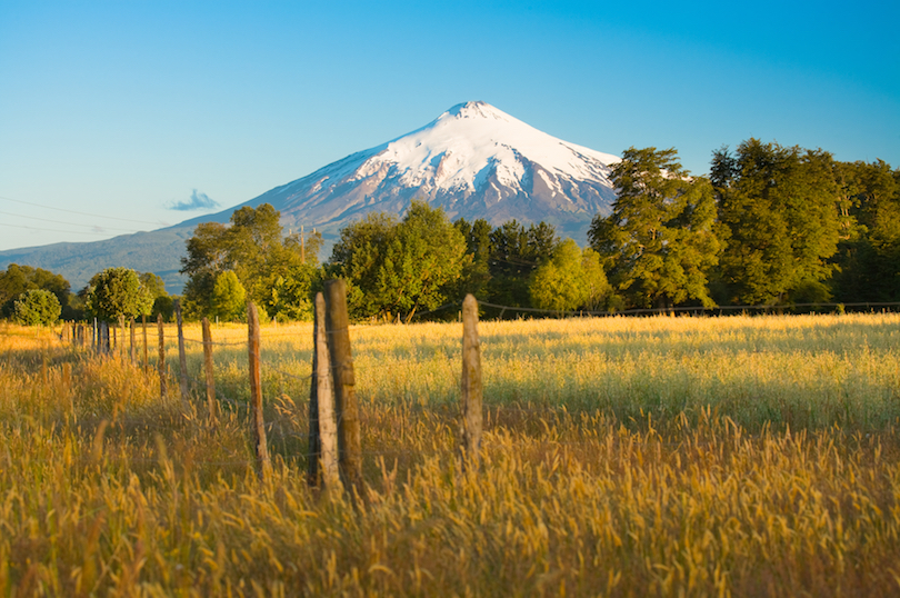
With ancient native forests, lakes, volcanoes, plenty of national parks and nature reserves, as well as ski resorts, Southern Chile is a beautiful place to be. In particular, the Parque Nacional Villarrica Sur near Conaripe is stunning and diverse.
This place is home to one of the most active volcanoes in Latin America – the almost 3,000 meter high Volcan Villarrica itself – situated in front of a glassy lake of the same name. Here you will also have the opportunity to walk on painted boardwalks above steaming hot springs – the Termas Geométricas – in mossy, primeval forests for an almost mythical experience.
For more inland wonder, there are the temperate rainforests of the Heurquehue National Park, featuring practically prehistoric scenery, with lagoons and monkey puzzle trees galore. Isla Mocha – located off the coast of the southern Biobío Region – is a nature reserve in itself. In native Mapuche mythology, this beautiful place is an isle of ghosts, while in the age of the pirates, it was a known hideout.
Los Lagos
Andean mountains, hot springs, active volcanoes, glaciers, and, of course, languid lakes – Los Lagos is where Chile begins to get truly rugged. The weather here is characterized by a lot of year-round precipitation, making for a moody atmosphere.
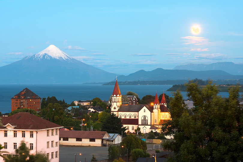
Osorno Volcano, on the southeastern shore of Llanquihue Lake, is a 2,652-meter tall stratovolcano that dominates the skyline like a Chilean Fuji. It’s an iconic landmark, with nearby interesting rock formations and colorful surroundings.
Todos los Santos Lake within the Vincent Perez Rosales National Park is an alpine lake with temperate rainforests and volcanoes in abundance close by.
There’s also Chiloe Island, which is the main isle of the eponymous archipelago and the namesake of Chiloe National Park – a place of Valdivian temperate rainforests, bogs, and dunes. It’s a breeding ground for Magellanic as well as Humboldt penguins, and just off the northwest coast, it’s also possible to spot blue whales.
Aysén
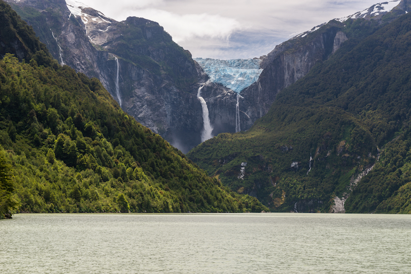
The Aysén del General Carlos Ibáñez del Campo Región – or Aysén Region for short – is the northern end of Chile’s roadless wilderness of Patagonia. This sparsely populated area is blanketed by glaciers, carved with mirror-like fjords, and pockmarked with snowy mountains.
The Laguna San Rafael National Park is where visitors can find the vast Northern Patagonian Ice Field, a frozen land where glaciers feed lakes and rivers at high altitude. Here you can spot the Cerro Castillo, a jutting, 2,675-metre-tall peak named for the castle-like walls. Adventurous travelers can trek around the Cerro Castillo Nature Reserve thanks to its many trails.
The Puerto Chacabuco is known for being the gateway to kayaking this region’s majestic fjords. This is also one of the best ways to get up close to the giant San Rafael Glacier itself, which makes up part of the Northern Patagonian Ice Field.
Magallanes
Magallanes – or Southern Patagonia – is the southernmost, largest, and second-least populated region of Chile. Also comprising Antarctic Territory, this is Chile’s almost uninhabitable deep south, known for craggy fjords, islands like Tierra del Fuego, and countless peaks.
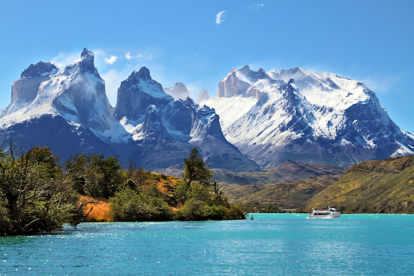
One of the most famous of these mountains is Monte Fitz Roy. Set on the Chile-Argentina border, its multiple spires exude the air of a fantasy landscape, as its highest point soars to 3,405 meters above sea level. Similarly, a view of the Torres del Paine from Lake Pehoé is sublime.
Then there’s the Pali-Aike National Park. Aptly meaning “Desolate Place” in the native Tehuelche language, this national park features an incredible volcanic crater as its centerpiece.
Alberto de Agostini National Park is a vast, million-hectare-plus stretch of wilderness, home to the Darwin Mountain Range – the final, land-based stretch of the Andes. Wildlife is in abundance here, from the fluffy Andean fox to South American sea lions and even humpback whales.
Juan Fernández Islands
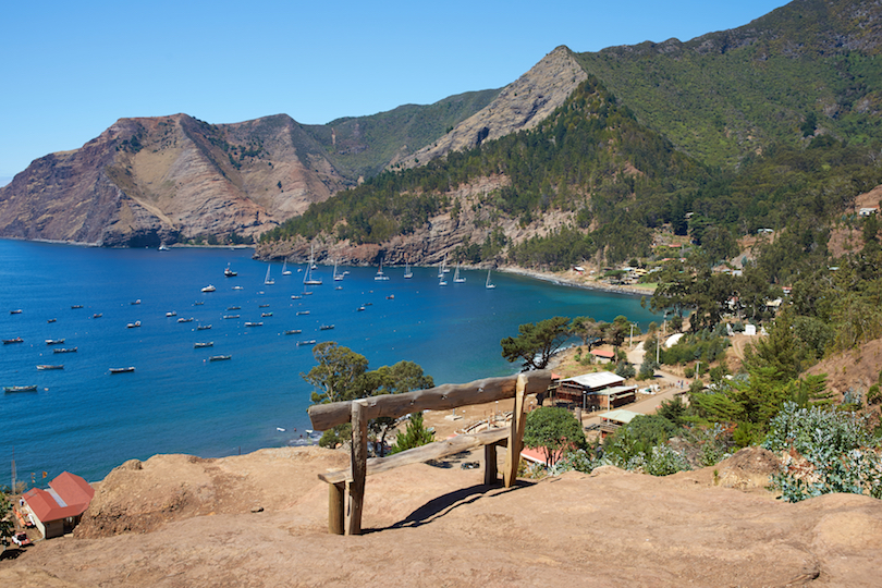
Located 667 kilometers off the coast of Valparaiso are the Juan Fernández Islands. These islands have been formed from the tops of volcanoes, rising from the Juan Fernández Submarine Ridge, resulting in a remote and genuinely remarkable landscape.
Sixty percent of the plants here are indigenous to this subtropical archipelago, so it’s a good thing indeed that the Juan Fernández Islands are also a national park.
There are three main islands here – Robinson Crusoe, Alexander Selkirk, and Santa Clara. Famously, these islands were where sailor Alexander Selkirk spent four years marooned, inspiring Daniel Defoe’s book, Robinson Crusoe.
Alexander Selkirk, the second-largest island, bristles with thick woods, ravines, rugged cliffs, and some sandy beaches. Hiking the trails of El Yunque Peak yields beautiful views.
Santa Clara, on the other hand, is a dry shrubland covered in grasses. There are also multiple dive sites, especially around the island of Robinson Crusoe. Fur seals and rare birds can be spotted here, too.
Easter Island
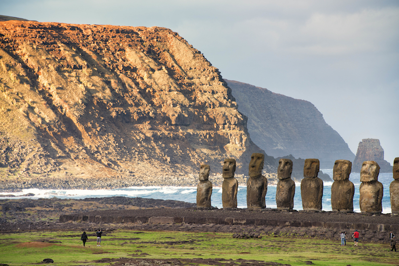
Easter Island is one of the most enigmatic, iconic, and remote islands in the world. This incredible Polynesian volcanic island in the South Pacific is also known by its native name – Rapa Nui. It’s known, of course, for the mysterious stone heads or moai, which number almost a thousand – 887, to be precise.
Most of the island is protected by Rapa Nui National Park, which consists of three main volcanoes, archaeological sites, islets, beaches – such as the white coral-sand beach of Anakena – and walking trails. Hiking the largest volcano of Rano Kau is an incredible way to see the island and the lush crater of the extinct volcano itself.
However, the biggest draw to this island has to be the intriguing moai and the culture of the Rapa Nui people who created them, arriving on the island around 1200 AD. Here you will find caves complete with paintings, ruins of stone houses, stone walls and platforms, as well as petroglyphs.


Leave a Reply