A monument to the power of nature and a shrine to conservation, Yosemite is one of America’s grandest and most popular national parks. Carved by ancient glaciers, the park features massive granite rock formations, roaring waterfalls, meandering rivers, lushly forested valleys and grassy meadows. Located around 200 miles (320 km) east of San Francisco, the wilderness area was first protected in 1864, thanks to the tireless efforts of Scottish-American naturalist John Muir.
Today, nearly 4 million people come to Yosemite each year to explore the majestic park. Although many of the best-known attractions in Yosemite can be viewed from Yosemite Valley, walks and hikes on the more than 800 miles (1,300 km) of park trails reward visitors with scenes of breathtaking beauty, from high-country meadows to ancient sequoia forests.
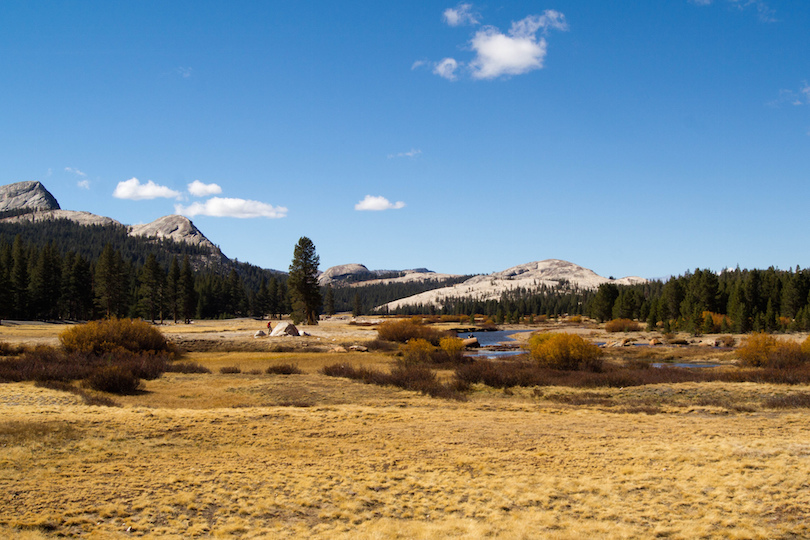
10. Tuolumne Meadows[SEE MAP]
The region around Yosemite features landscapes of great diversity, including the high plateau of Tuolumne Meadows. Located around an hour’s drive northeast of Yosemite Valley, Tuolomne’s flat basin is surrounded by steep granite rock formations and domes. An ideal destination for family vacations, Tuolumne Meadows is a favorite spot for camping, fishing and swimming in the Tuolumne River. Easy hikes to the Soda Springs natural springs and along the John Muir Trail are popular pastimes. Day trips to the region’s beautiful lakes are can’t-miss activities as well.
9. Bridalveil Falls[SEE MAP]
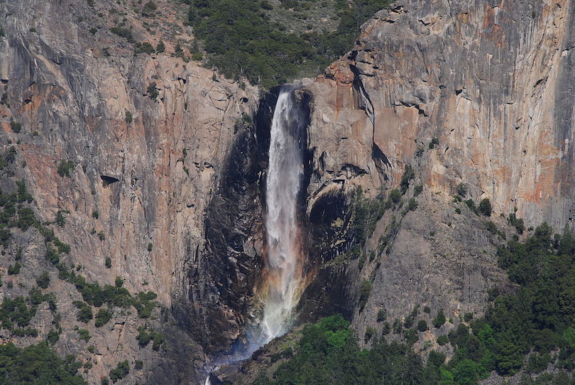 Asamudra / Wikipedia
Bridalveil Falls is one of the first things people see when entering Yosemite from the west. Standing more than 60 stories high, the falls are most impressive in the spring when snowmelt swells the flow into a thundering roar. Bridalveil Falls is subject to the wind in any season, and the way the falls blow from side to side is part of what makes this water feature so distinctive. A 20-minute walk from the Bridalveil Fall parking area brings visitors to the base of the falls. Despite a steep ascent at the end of the trail, it’s one of the easiest hikes in the park.
8. Sentinel Dome[SEE MAP]
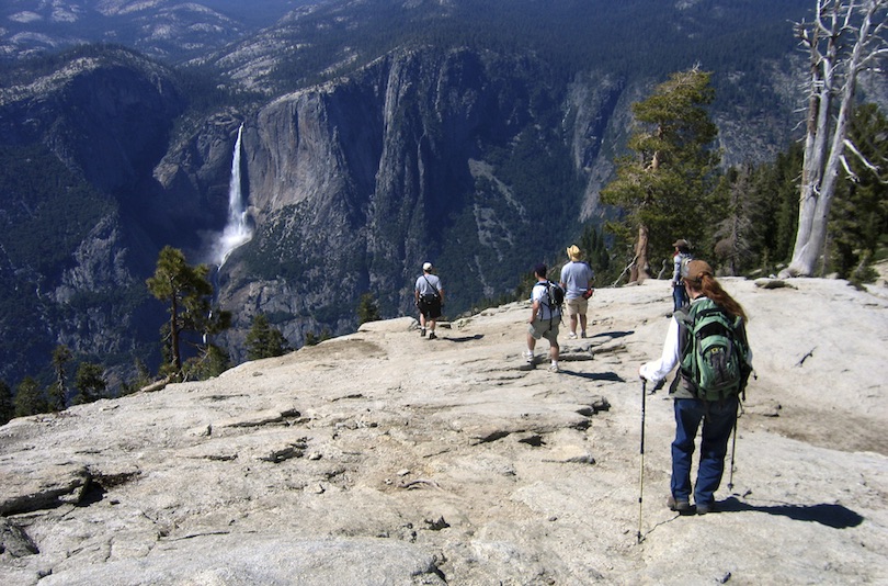
Located on the southern side of Yosemite Valley, Sentinel Dome is best known for a photograph Ansel Adams took of the summit in 1940, which featured a wind-swept pine tree seemingly growing out of the rock. Although the 400-year-old tree toppled in 2003, the rocky peak remains a popular hiking destination. An hour-long trek takes visitors over the northeast granite slope of the dome to the top to enjoy picture-perfect views of the park. During the winter, the dome can be reach via ski tours from Badger Pass.
7. El Capitan[SEE MAP]
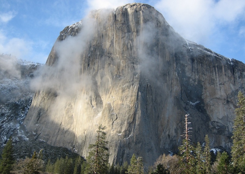
One of the most famous sights in Yosemite National Park, the granite monolith El Capitan rises almost 910 meter (3,000 foot) vertically from Yosemite Valey. It is is a favorite challenge among expert rock climbers. In 1958, Warren J. Harding, Wayne Merry and George Whitmore were the first to climb the Nose of El Capitan using ropes, pitons and expansion bolts. This famous Yosemite attraction is best seen from the roads in western Yosemite Valley, including Tunnel View, Bridalveil Fall area, and El Capitan Meadow.
6. Mariposa Grove[SEE MAP]
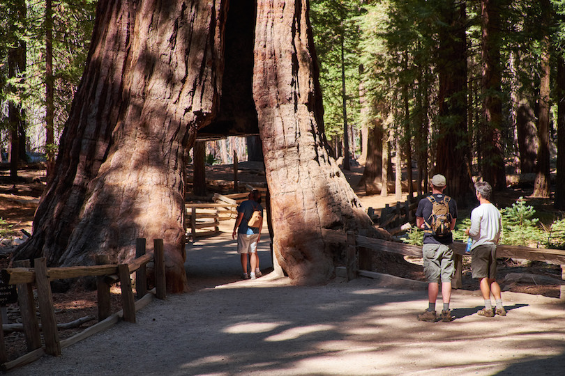
Located in the southernmost part of Yosemite National Park, the Mariposa Grove is a protected forest of giant sequoias, some of which have been growing for more than 2,000 years. Star sequoia specimens include the Washington tree, the grove’s largest, and the California Tunnel tree, which was cut in the 1800s to allow horse-drawn carriages to pass through. Toppled giants like the Fallen Monarch are notable as well. Open-air trams offer engaging tours of Mariposa Grove, and visitors can hop on and off the tram to walk around the mammoth trees.
5. Half Dome[SEE MAP]
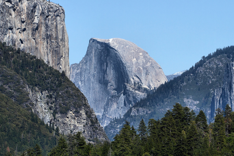
Yosemite’s most recognized geological feature, Half Dome’s near-vertical northern face has enticed rock climbers for more than a century, but intrepid visitors can also reach the top by way of a long and arduous trail from the floor of Yosemite Valley. The last section of the trail has two cable handrails that offer support for the steep ascent. Visitors who don’t find the idea of a day-long trek up Half Dome appealing can enjoy beautiful views of the park’s most famous landmark from dozens of valley locations and viewpoints in the park.
4. Vernal Falls[SEE MAP]
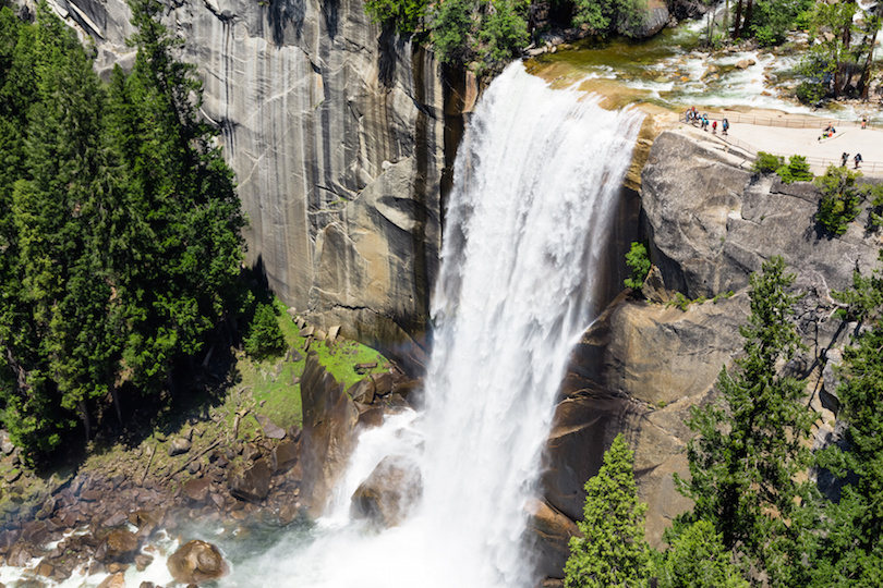
Situated in the eastern section of Yosemite Valley, the 317-foot (97-meter) high Vernal Falls flows into the Merced River all year, even when other waterfalls in the park go dry. Climbing the more than 500 granite steps to the top of the falls is one of the park’s most popular hikes. Mist from the falls make the trail slick, and hikers can expert to get wet along the way, but the vistas offered from the summit are truly spectacular. For less adventurous visitors, a footbridge located around halfway up the climb provides scenic views of the falls and the valley.
3. Yosemite Falls[SEE MAP]
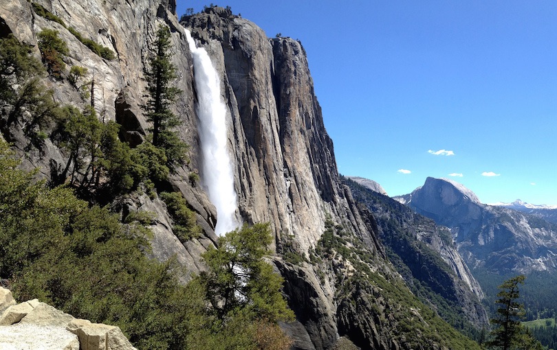
The tallest waterfall in the United States, Yosemite Falls pours down a cliff side in three cascades and provides picturesque views from multiple locations within Yosemite National Park in California. A challenging all-day hike takes visitors to the summit for panoramic vistas of the majestic park and the towering Sierra Mountains beyond. The falls vary in water flow, however, and sometimes disappear entirely during drought conditions. The best time to enjoy the splashing water and thunderous roar of the falls is in the spring after the winter thaw.
2. Tunnel View[SEE MAP]
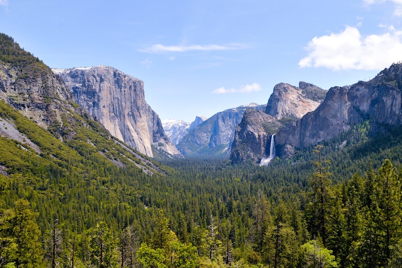
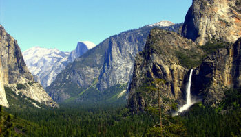
Located in Yosemite National Park in the Sierra Nevada Mountains of central eastern California, Tunnel View is an overlook where visitors can enjoy amazing views of El Capital, Bridalveil Falls, Half Dome and the gorgeous Yosemite Valley. The overlook, which was first built in 1993, was renovated in 2008. Tunnel View is very popular with park visitors, and it attracts between 5,000 and 7,000 visitors a day during the tourist high season. Travelers can find Tunnel View at the east end of the Wawona Tunnel off of Wawona Road.
1. Glacier Point[SEE MAP]
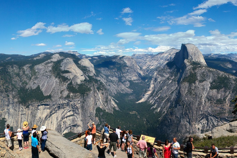
An overlook that offers sweeping views of Yosemite Valley, Glacier Point is accessible by foot, car or bus during the long warm-weather season and by cross-country skiing in winter. Because the four-mile trek to the point is steep and arduous, most visitors prefer to drive or take a tour bus on Wawona Road. It takes around one hour to drive the winding road to the summit. Glacier Point not only commands panoramic views of the valley but brings visitors eye level with the park’s iconic Half Dome as well.


Leave a Reply